
We took a few days vacation to create a four-day weekend and planned on doing either a canoe or backpack trip. With Oliver's (dog) health concerns we decided a canoe trip would be best, if he was up for a foray. We gathered a trip report from the Campbell River Tourism Branch that indicated the Sayward route may take up to 10 days. This was a far cry from the 4 days that most guide books indicate. I spoke to a few others and decided that we have enough experience to complete in at least 4 days, Sayward Forest Canoe Route is was!
To ensure we maximized our time we drove up to Campbell River on Thursday evening. We pulled up to Mohun Lake Forest Recreation Site (our starting point) by 11pm with two other parties already there. Considering it was dark and we did not want to disturb the others we moved things around and crowded into the back of the Jimmy, Quiggs got shot-gun and Heather, Oliver and I squeezed into the back. I arouse by 7:30 and took the boys down to the lake for a drink, the others were not up yet so I sat on the tailgate of the truck and enjoyed the serene setting. By about 8am others were moving so I tugged on Heather and we sprung into action. After chatting with one of the other groups and eating some granola we were off shortly after 9am.

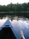
The view up from the west arm of Mohun Lake.
Not sure what we were in for, we enjoyed the calm waters and paddled up to the north arm of Mohun. After about 1 hour of paddling we reached the mouth of the north arm and stopped for a snack. The boys requested some mandatory stick play!

Looking back at Mount Albert Edward

Oliver grabbing a drink at our lunch stop.
As we reached the north arm we needed to gracfully navigate through a small narrow to reach the portage (could be a carry-over in late summer. The views behind us at this point were wonderful.

Strathcona Park from North Arm of Mohun Lake.
The portage was easy to find, center right of the bay, with a small campsite and an enclosed pit toilet. We carried on with the portage to Twin Lake and the swamps. The portage was well maintained, however, a few of the bridges may cause trouble in the next 5-10 years. There were a few canoe rests for those looking for a break on the 1.6km portage. We do all of our portages in two trips, this allows me to enjoy the portage without a canoe on my head and makes for lighter loads - enjoy the journey!
We reached the Twin Lake swamp and had a short paddle to another portage. This portage lead to a dried up swamp and left us with a decision to make. We figured the only option was to line the canoe while walking through the muck. Unfortunately, we did not take any pictures as the cameras were sealed up in their dry bag - it was messy. Heather did take this one video prior to the swamp-walk.
The dogs mucked through the swamp and had to contend with the bugs, they were nasty. We got the canoe over a few abandoned beaver dams and put Oliver in the canoe. Quiggs still had lots of energy so we let him swim alongside the canoe until we hit Twin Lakes. A very short paddle found us on the west end of Twin Lakes and the Forest Recreation Site. To find the portage you walk out to the logging road turn left and cross the bridge and find the portage on the other side of the road immediately after the bridge. The 0.8km portage was well maintained, but had a few good hills. We hit our destination of Amor Lake and looked forward to finding a nice site to set-up for the evening. Shortly after entering the water we had some wonderful views of Golden Hinde and the Behinde in Strathcona Park.

The Hinde and the Behinde
We were looking for the sites found in the Backroads Mapbook called "Sterling Island and Sterling Beach Sites". We found no sign of them (did not complete an exhaustive search) and continued on to a small island that was home to a small site with pit toilet (courtesy the Comox Paddling Club). A family was here and they mentioned some nice beach sites on the west side of the lake. As we paddled across Heather snapped this picture of Mount Albert Edward peaking over the mountains.

Mount Albert Edward
We pulled up to lovely beach site with pit toilet (courtesy of Comox Paddling Club again) and a cooking area built on an old root system (quite interesting). We set up the tent and enjoyed a nice meal followed by a swim, some reading and more yahtze! We decided to have a small fire as the sun went down which capped off a great day.

Campfire on the beach

Heather giving a tired Oliver some love!
After sleeping in until 8:30am we decided to enjoy the beach spot a little and had a nice swim and took our time heading out in the morning. We pushed off by about 11am and had a 2km paddle to the portage to Surprise Lake. The portage was home to Mr. Canoehead Recreation Site with spots to set up camp. Surprise Lake was a short paddle and lead us to the longest portage on the route, to Brewster Lake. The portage trail meets up with a logging road, however, the trail continues on the left hand side of the road. We took out first load through the trail (a few fall-downs, requires some attention), but took the last load (with canoe) on the logging road (save 10 minutes). The views at Brewster were amazing!

Mount Albert Edward

Mount Albert Edward and Marble Meadows area
Heather took a short video of the panorama and added a little Birthday Wish
By this time we were getting hungry and pulled off on a nice beach with a beautiful backdrop. As we were quite hot from the portage and paddling I pumped some more water while Heather put together lunch. Such a beautiful spot begged us to hop in for another dip!

Beautiful spot for a swim
We got on our way and headed to the portage that lead to Gray Lake. The wind was still down and the paddling was smooth. As we neared the end of Gray Lake we noticed a log jam on an old decrepit trestle. Luckily the pull-out for the portage was before this mess and we walked through a bunch of campers at the Gray Lake Forest Recreation Site. One gentleman was out in a floating chair with a cold beer and we pondered who had things straight, us or him?
NOTE: The Forest Service has posted a sign (June 2008) indicating that one should take the portage route due to a log jam. As you come to the normal put in (on the other side of the trestle log jam) you will notice a deer cut to the left, DO NOT take this, it looks as though a canoe would be difficult to get through the tight quarters. We decided to paddle across to the next portage that goes around the rapids - this way was clear all the way to Whymper Lake. I would highly suggest staying away from any of the log jams, they can be very dangerous. Footing will rarely be stable and the water runs quite quickly under the jam creating a tricky current. We portaged around all of the log jams along the way.
After feeling like we were carrying our gear in and out of the canoe more that we were paddling we were happy to finally reach Fry Lake. Fry Lake is car accessible and showed, there were campers and people skirting the shores. We were tired and really wanted a spot that we did not have to worry about the dogs bothering others. We found a sandy spit at the mouth of Campbell Lake and decided to make camp. A quick meal, swim and fire and we were sound asleep, regardless of the rowdies on Fry Lake.

Sunset looking back at Fry Lake
We paddled on the large Lower Campbell Lake blessed with another calm day. In the distance you could see the Coast Mountains on the Mainland. The lake was obviously man-made as the large tree stumps underwater were obviously created by damming in the area (Strathcona Dam I suspect). There were car accessible sites all along the north shore of the lake and our destination was Gosling Bay Recreation Site. This portage linked together two logging roads and a small trail that lead to Gosling Lake. The one logging road had a steady grade, we decided to have lunch on Gosling Lake before our final push. With three small lakes left we felt we would be done easily by the early evening. We encountered our first wind on Gosling, however, the short paddle was not difficult. A look behind us gave us out last views of Strathcona.

Glad we took pictures
The portage from Gosling Lake lead us to Higgins Swamp Channel (easily passable with a little care) and to Higgins Lake. This small lake lead to another small portage to Lawier Lake and our final 1km paddle to the end of the route. A beautiful trip, well marked portages, a swamp walk and a little adversity equalled a wonderful trip. The one downfall was the amount of car accessible sites along the way taking away from the "wilderness feel" and made finding a campsite difficult at times. All in all a nice short canoe route!
3 comments:
Hey Jarrod, great trip report. The videos add something, I have been wondering about including some myself. I’ve heard that mud bath between Goose and Twin can be a real trial. Sounds like you two took it with good humour. I am drawn back to the Sayward Forest area for the variety of shorelines and small lake charm. The multiple road access does make it well used, but on the other hand for folks like me with less brawn than in years past, it allows for day and overnight trips in a relatively natural setting. No houses/cabins on these lake yet! I sure wish this area was protected. Anyway, thanks for the time and effort involved in putting together this great report. Good photos too.
Richard
What a surprise to find such a fine report about the Sayward Forest Canoe Circuit. I could not have been more pleased. Obviously, many of us love the circuit and believe that it must be known and used by paddlers. This blog goes a long way to do this. Following in that line of thought, I would like to inform paddlers that I have written a book on the Sayward Circuit which I will release in a few months through an imprint called Dogwood Avenue Books. The 90-page book will be available at any bookstore or on the internet. It will contains maps, GPS waypoints, and detailed descriptions of every campsite and portage on the circuit, as well as interesting comments on the natural history of the circuit. You and your readers can check out what the cover will look like at http://dogwoodavenue.ca .
Cheers
Michel Gauthier
Hi,
Thanks for the info. I agree, apart from your blog there is not enough info for this trail. Would you have a map of the circuit by any chance?
How many days to complete the circuit and did you paddle most of it between the lakes or did portage?
Thanks
Post a Comment