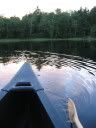
Our friend Eric Busch stopped in to visit us for 4 days before he headed off to the South Pacific for 9 months. We wanted to do a hike and due to the extremely wet weather we felt going to McNair Cabin in Tetrahedron Provincial Park would be a good choice. We gained access to the park at the end of McNair FSR. The first hour found you being molested by slide alder and the last hour took you accross several slides (caution in the winter). We hit snow at the mouth of McNair Creek and crossed over to gain west side of the lake. We post-holed for about a half hour and got to the cabin. We got the wood stove roaring and dryed off our clothes. We drank hot chocolate and Bailey's and played a few boardgames. A good relaxing evening.
It rained all evening and on the way out the next morning the water was rushing. McNair Creek has a fairly wide bed and the added volume did not make the creek ford any more difficult. Where things got fun was the last washout before the parking area. A small seasonal feeder stream was gushing down as a waterfall. Eric took a video with his very compact waterproof video/picture camera.
Check it out............
Friday, November 9, 2007
Sunday, September 16, 2007
Manning Provincial Park - Heather Trail - July 23, 2007
While my parents were here it was our goal to get them into an alpine hike. Given the time of year we felt a hike into the sub-alpine meadows of the Heather Trail would be a perfect day. The final destination was First Brother Mountain and the beautiful views of open alpine ridges. We set off early in the morning as we new the 20+km return trip would take most of the day.
On the way up to the parking lot just below Blackwell Peak we stopped to look at the Northern Cascades in the distance.

This view was too tempting for snappy!
We headed down the well beaten and wide track and marveled at the surrounding wildflowers.

My father and I with the dogs (they generally walk off-leash, however, the sensitive flowers are easily damaged)
There were too many pictures to post, but, I will post a few along the way...

Beautiful Wild Columbine
As we walked along the easily followed trail we enjoyed good conversation and beautiful views.

Mom and I with our destination in the far distance.
As we worked our way through the alpine lupine and heather we came upon a fairly relaxed fellow.

Heather was able to get up close and personal with this grouse.
We followed the trail and came upon an outhouse and then shortly after the Buckhorn Camp. This camp had tent pads and a few streams running through for water. Seemed like quite a nice little spot in the woods. After Buckhorn camp we started our ascent of the shoulder of the Big Buck Mountain. This would give us access to the open sub-alpine meadows that we came to see,

Pushing up and forward.
It was a misty day so the views of the Northern Cascades and other mountains in Manning Park were slightly inhibited, however they were still quite inspiring.

Misty, gloomy day looking south.

Amazing sky scape.
Although the weather was cooler than normal it actually made for comfortable hiking as we didn't have the sun beating down on us relentlessly. As the day progressed we received more and more sunny breaks which was nice.
As we moved closer and closer to our destination we thought it would be neat to take pictures of our progress.

Here are my parents enjoying the mountain air (a little closer to the First Brother).
As we came closer and closer to the shoulder of Big Buck we saw more and more flowers

The paintbrush was incredible.

The Heather was abundant (obviously).
As we reached the shoulder my mother could not resist the final patches of snow in the summer, while my father pondered life!

Snow Angels!

The Thinker.
While on the shoulder of Big Buck we were able to look out along the ridge line that led to Big Buck as well as the ridge line that led to the First Brother.

Big Buck

First Brother
As we gained the ridge leading to the Three Brothers we decided to have lunch and step out of the wind. After lunch we began walking along the ridge.

The flowers were still out en mass.

Beautiful picture taken by Heather.
We gained the col between the First and Second brother and headed towards the First Brother. The ridge line was beautiful and was one of the more spectacular walks we have done. The wind was howling and made for uneasy walking even though the ridge was quite safe and broad.

Mom, Dad and I making the final push.
We came upon a small scramble that made us stop to assess the skill level required. Considering we had been hiking for awhlie by this point we also wanted to catch our breath. With the wind blowing on the ridge, my mother was feeling a bit of vertigo. She felt it was best for her to sit at this point and enjoy the view. My father, Heather and I decided to pop up to the top quickly and then back down. On the peak the wind was blowing even stronger.

You can see the wind blowing our hair and Quiggsley's ears.

Dad and Heather working their way down.

This was a long, but rewarding day. The day offered incredible contrasts with the sub-alpine meadows and the barren ridge lines of the alpine. Great day had by all!
Wednesday, August 15, 2007
Porpoises on the Inlet - July 8 & 9
My parents came to visit us in Sechelt and brought their new kayaks and an adventurous spirit. We did a tonne of hiking and paddling and had plenty of fun evenings playing cards and watching movies. My Mother, Heather and I have done some backcountry camping, however my father has, to this point, been adverse at the notion. We gave him no choice and we headed up the Sechelt Inlet for a one-nighter.
We got off by about 9:30am after I had to head back to get our paddles, are they a necessity? It was interesting to see how layed-back packing is when your jumping point is only 15 minutes away. It was a misty day and all of us feared the signs of rain.

We only explored the shoreline a little as the gloomy day sapped our creative spirit. We landed at some of the pocket beaches with marine camping sites, however, the goal was Halfway Beach and setting up camp before any rain reared it's ugly head. Heather and I paddled the Two Dogs, Dad rode Mango and my Mom sizzled in Red is Best.

Here is a shot of the Mango Man!

The two yak's taking a rest on Halfway Beach

Misty group shot looking up Salmon Inlet with the Tantalus Range in the distance
Luckily, the rain did not come. I was chomping at the bit to get in one of the kayaks and when everyone laid down and took a nap I took Red is Best and played in the tidal water. Mango could not be contained so my Dad joined me.

Here is Mango, posing.
We had fun setting up camp with my folks.

My Dad pitching Trusty Green.
Heather went to show my Dad how to pump water. It looked like the sun was coming out so my Mother and I went to see. As we walked back to camp my mother turned back and remarked "What are those, are those the porpoises you have been talking about?". In fact it was! So I ran back to the creek to inform the water-makers and we dropped what we were doing and loaded up - Heather took Red, PJ had Mango and Mom and I floated Two Dogs.

Mango and Red got there first and waited for some action.
It wasn't long and the porpoises were jumping and playing. It was amazing, they were beautiful and friendly and came quite close to the boats at times. The harbour seals had to make an appearance as they were not to be excluded from such fun. Good snaps were hard to come by as the porpoises were very quick. Heather had the most luck as they initially surrounded her. Below are only a few of the hundred or so shots we took.

The only head on shot taken -- nice!

Nice side shot.

Up close.
After the porpoises headed up inlet we decided to paddle across the Salmon Inlet to Kunechin Point and the bird sanctuary. There are a couple of camping spots and the area is host to many scuba divers as there is an artificial reef here (old war ship).

My Dad taking shots of the black oyster catchers, harbour seals, cormonts, and bald eagles.

Quiggs with Snappy taking pictures in the background.

Oliver and my Mom
We headed back and had steak and camp potatoes with Heather's corn tortilla sugar desserts. We played some euchre and hit the sheets as we just finished a big day of paddling.
We woke up to a beautiful day with calm waters and bright skies. This was what we were looking for. We got moving earlier to take advantage of the calm water. We crossed the convergence of Salmon and Sechelt Inlets to Nine Mile Point and marveled at the surrounding scenery.

Here is my mother with the Tantalus Icefield in the distance.

It doesn't get much better.

The inlet truly is a beautiful spot.
We took in sea anemones sea cucumbers, crabs, starfish, sunfish and other marine life along the way. I was tempted by many of rocks on our route home.

Great trip folks! Cannot wait for the next....
Monday, August 6, 2007
Bushwhacking on the Sunshine Coast Trail - June 24-26, 2007
Heather and I have been wanting to check out some of the SCT since we got here last September. We had three days off in late June before my parents arrived and we decided to take a break from deck building and take in the Tin Hat Mountain section of the SCT.
~DAY 1~
We took the first ferry from Earl's Cove (Sunshine Coast) to Saltery Bay (Powell River Penninsula) to give us enough time to check out the town of Powell River and get on the trail in the morning. It started out as a misty day and we were fearful that we would get caught in the rain all day, but were happy in knowing that the first section of trail was all under tree cover.
 Here we are pulling into the berth at the Saltery Bay ferry terminal.
We headed up Goat Main Logging Road to get to the start of our section. These roads are home to active logging and care should be taken when driving. I later found out that many people rent a radio so that they can hear when the trucks are coming. Luckily, we did not run into any trucks. Along the way you could see extensive logging in the area, which offered a few views of the surrounding lakes -- many of them part of the Powell River Forest Canoe Route.

Views of Lois Lake from the foothills of the Smith Range provided by a cut-block.
We used the trail guide by R.E. Walz and found it very descriptive, but, not always the most accurate. We were able to follow Goat Main to the Tin Hat Jctn, but, got stuck for about 2 hours, searching for the trailhead described in the book.

The book describes passing by the 4km mark and hitting a road to Lewis Lake with a trail shortly after. We passed a road that had a sign indicating "Lewis Lake", however, there was no trail in the vicinity. After the searching and walking up and down, we decided to drive further up the road and stumbled across an area that looked like the trailhead. We now realized that the trail guide should have said 4miles, not 4km....arrrghhhh!

So we suited up and hit the trail skirting Spring Lake with the final destination for the day being the Lewis Lake Forest Site.

The trip started with a well beaten trail and was easy to follow. We were happy to finally hit the trail and enjoyed the thick forest canopy and lush floor with oodles of course woody debris (CWD) -- hahaha.

However, as we got further into the trail the ferns started to make the trail more difficult to follow. Glass half-full, this allowed us to exercise our route finding skills. Additionally, this was my first overnighter using my new GPS, so I was interested to see how this new gadget would fit into the traditional compass and map tools that we generally use.

Our route finding skills were not finished being tested as we came to a section that lead to a logging road that was not on the map. Both sides of the trail were thick with fall-down and debris from the road development. So we wrestled our way to the new road and pulled off our packs and had a drink. We bushwacked on the other side and came up to what appeared to be an old cart-path. We could hear water lapping not too far away, and were confident that this was probably the trail that lead to the camp -- and we were right.

Our new MEC Apollo tent was nice, however, the tent pads were very firm and difficult to knock in our tent pegs.

The site also had a long dock, as the new logging road gave easy access -- I assume there is probably good fishing in Lewis Lake. We made dinner and hit the sheets with our eyes on a full day to the top of Tin Hat Mountain and back to Lewis Lake.
~DAY 2~
We started with breakfast and hung our food and were off by 9am. We headed back along the cart path and connected with the trail. This section was said to be completed in 2003, however, all we knew for sure is that the route has been marked. The beginning of the trail around the south tip of Lewis Lake was very well developed and made for an enjoyable start. There were reminants and many reminders of the areas old growth past.

Heather posing by a fallen monster -- now that's some CWD!
As we progressed we came upon more and more blow down. It was apparent that this section had not been cleared yet -- I knew I should have brought my bow saw! We took everything in stride and took in some of the neat things this forest had to offer.

Heather was taken by this fungae and took some cool pictures.
It was not long before we were again amongst some very heavy blow down. We realized that the trail was now skirted by a new logging road, which opened up the area for the winds to blow. There was also alot of "scrap-brush" and "leftovers" from the road development. By this time there was no trail and we were climbing up and over everthing. After about an hour we finally got to the logging road to reasess.

Here is a view of the "trail" that we were following.
We decided to look for a small creek which would eventually hook back up to the trail. We walked along the logging road and picked up the creek. Of course there was immense blow down along the creek, however, at this point we were feeling good about our route finding skills and felt we needed an advanced test. We whacked up the creek until we came upon a pink flag on the other side of the creek, and a beautiful tree being used as a bridge. We had picked the trail back up -- yahoo!

This is Heather finally enjoying being able to walk without the constant barrage of fallen trees - this tree was to our advantage!
We took a flagged route, which by our calculations was running in the right direction. We hit a small series of Lakes/Ponds after about 2km and were happy to come upon Lac Godeau, Sofia Pond & Cranberry Pond within about a half hour. We stopped at Sofia Pond and took a dip and had a snack. After about a half hour break we suited up and were ready for the approximately 800m elevation gain to the top of Tin Hat (1150m). We continued to follow a slightly logical flagged route, however, after about an hour of zig-zagging, with no apparent purpose we headed for the ridge that would lead to the top of Tin Hat. We gained the ridge and started our ascent. Again there was no trail on the west access to Tin Hat, and we found ourselves whacking up the side of the mountain. We finally picked up flagging again and at this point seemed to be following a much more logical route. We finally reached a few rocky outcrops and turned around for the beautiful views of Lewis Lake (front), Ireland Lake (middle right), Dodd Lake (middle left) and the meeting of Horsehoe Lake & Nanton Lake (back) -- all part of the Powell River Forest Canoe Route.


We continued up the mountain, still heavy bushwhacking and wanting the top more than ever. There were a few more lookouts and views as we worked our way up the mountain.

Views of the Georgia Strait and Texada Island on our way up.

Views west of the Knuckleheads and Mount Freda area (Mount Freda is the snow-topped center left & Diadem the sharp point just left of that)

Views north of Beartooth Mountain on the Rainbown Range
As we got closer there were a few rocky sections which allowed us to test our scrambling skills. We have not done a tonne of scrambling, but have always enjoyed the little that we have done.

Here is Heather smiling in the enjoyment of some easy scrambling.
We rambled through a few small meadowy sections filled with Heather and enjoyed the more open country as we started to get above the tree line. There were views everywhere we looked and too many pictures to post. You could take in most of the Canoe Route, which was neat.

I am already planning the trip on the Canoe Route -- next summer!
We pushed further and now had views of the cairn at the top of Tin Hat. By this point our legs were weary from the bushwhacking, yet still anticipating the views from the top.

Heather making the final push with the cairn in the background.
We passed through a few snowy sections and were at the top with the happy Leprachaun (cairn) -- we figured the cairn was for the heli-pad which consisted of two peices of lumber lying on the ground with "HELI-PAD" etched into them.

The summit provided 360 degree views that our pictures will not do justice. It was getting late and the bugs were out on top so we had a quick meal, took some pictures and decided to head east to hook up with an old logging road that lead to the more traditional access trail to Tin Hat. After 8 hours of whacking (for a planned 3-4 hour return trip), we were not in the mood for whacking any longer!
Here are a few pics from the top....
Quiggs enjoying the views.

Oliver is such a poser! Beartooth Mountains in the back...

Heather and Quiggs.

Goofing around on top.

Heather and I

We headed back to our camp along the "rubble-rich road" as it is described in the trail guide. An old logging road, wide and clear, which was fine with us. We ate and crawled into bed. Day three consisted of getting out and catching the ferry.
Happy Trials and Trails!
Subscribe to:
Comments (Atom)